Telaga Merdada berada di area Pegunungan Dieng yang secara administratif terletak di Desa Karang Tengah Kecamatan Batur Kabupaten Banjarnegara Propinsi Jawa Tengah. Telaga Merdada memiliki luas daerah tangkapan (cathment area) sekitar 75 ha dengan luas genangan sekitar 22 ha dan kapasitas tampungan air diperkirakan sekitar 518.520 m³. Keberadaan Telaga Merdada memiliki nilai yang sangat penting bagi masyarakat sekitarnya karena merupakan sumber air bagi kegiatan pertanian di sekitar area telaga tersebut dan juga merupakan area penyangga ekologi dan ekosistem kawasan setempat. Meskipun daerah tangkapan air (cathment area) Telaga Merdada relatif kecil namun keberadaan air telaga tidak pernah mengalami kekeringan meskipun terus menerus digunakan untuk keperluan irigasi tanaman pertanian hortikultura yang luas, khususnya tanaman kentang.
Penggunaan lahan di Kawasan Telaga Merdada saat ini adalah untuk lahan pertanian dan sebagian masih berupa hutan/semak belukar. Luas lahan pertanian mencapai 44 ha sedangkan sisanya berupa hutan/semak sekitar 11 ha. Karena potensi sumberdaya air dan peranannya yang begitu signifikan bagi perekonomian masyarakat, maka keberadaan Telaga Merdada perlu mendapatkan perhatian pemerintah.

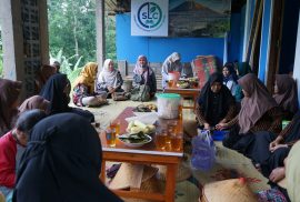
Pada tahun 2010, dilaksanakan program konservasi terpadu kerjasama antara Balai Besar Wilayah Sungai Serayu Opak (BBWS.SO) dengan Pusat Studi Agroekologi Universitas Gadjah Mada dengan melibatkan tim peneliti dari Jurusan Teknik Pertanian FTP UGM berupa pemasangan tandon air, penguatan teras dengan batu dan penanaman tanaman konservasi. Pemasangan tandon air bertujuan untuk mengurangi penggunaan pompa air, sehingga dapat menghemat biaya pengaksesan air untuk irigasi. Penguatan teras dan penanaman tanaman konservasi bertujuan untuk mengurangi erosi lahan dan sedimentasi serta untuk konservasi air dengan mengoptimalkan infiltrasi dan mengurangi limpasan permukaan (surface runoff). Pelaksanaan kegiatan melibatkan masyarakat petani disekitar telaga merdada sebagai pelaksana. Sosialisasi dilaksanakan untuk mendapatkan berbagai masukan dari masyarakat, agar tujuan kegiatan sesuai dengan kebutuhan masyarakat.
Pada kegiatan konservasi terpadu ini, juga dilaksanakan perbaikan saluran drainase dan perbaikan bangunan terjun (drop structure). Keberadaan saluran pembuangan yang baik mampu menurunkan erosi lahan dan mengotimalkan fungsi lahan dengan mengurangi kelebihan air. Perbaikan dan penguatan bangunan terjun untuk mengoptimalkan fungsi bangunan terjun dan meredam dampak dari energi yang ditimbulkan oleh aliran air yang berpotensi menimbulkan erosi alur. Sesuai dengan rencana, bak penampungan air berupa tandon diletakan pada titik tertinggi dilahan. Alasan pemilihan penggunaan tandon air dari pada pembuatan bak adalah karena faktor kemudahan dalam pengadaan dan pemindahan kelokasi yang ideal. Tandon air sebanyak dua unit dengan kapasitas masing-masing 1500 liter (total 3000 liter) dihubungkan dengan satu pipa input yang terhubung dengan pompa dan beberapa pipa output yang berfungsi mendistribusikan air ke lahan.

Perbaikan dan penguatan teras dilakukan dengan menyempurnakan bentuk fisik teras dan memasang batu sebagai penguat pada bagian depan teras, begitu juga dengan perbaikan dan penguatan SPA dan drop structure. Tinggi teras yang direncanakan adalah setinggi satu meter, namun karena kondisi horizontal interval yang tidak seragam maka pada pelaksanaannya menyesuaikan kondisi dilapangan.
Penanaman tanaman konservasi dilaksanakan di areal seluas 2-3 ha dibagian tepi lahan pertanian dengan jarak tanam sekitar 6 meter seperti yang direncanakan. Keberadaan tanaman konservasi diharapkan mampu meningkatkan penutupan vegetasi permanen untuk konservasi tanah dan air.

Merdada Lake is situated in the area of Dieng plateau which is administratively located in Karang Tengah village, Batur district, Banjarnegara regency, Central Java province. The lake covers around 75 ha of catchment area and 22 ha of inundated area to accommodate 518,520 m³ of water. This lake played an important role as water resource used for agriculture activities around the lake as well as to support the ecology and ecosystem of the area. Even though the catchment area is relatively small, the lake has never run out of water despite its continuous use for irrigation of wide horticulture activities, especially the potato farms.
The lake is mostly used for farm irrigation while partly is still in the forms of forest and bushes. The farm covers 44 ha of land, while the rest 11 ha is still forest and bushes. Because of its significant potential and role of the water resources in the community’s economy, the government should pay attention to the lake.

In 2010, a collaborative program was conducted by the Office of Serayu-Opak River Basin Development (BBWS.SO) and Center of Agro-ecology UGM involving research team from Department of Agricultural Engineering Faculty of Agricultural Technology UGM by building water tower, stoning the terrace, and planting the conservation plants. The water tower was built to reduce the cost of water for irrigation, while the stoning and planting activities aimed to reduce the land erosion and sedimentation as well as to protect the water by optimizing the infiltration and reducing the surface runoff. The program involved the farmers around the lake who acted to be the executors. Prior to the program, dissemination was conducted to get input from the community so that the program meets what they needed.

In this integrated conservation program, the improvement was also applied to the drainage channel and the drop structure. A good quality drainage system was able to reduce the land erosion and optimize the land utility as well as reduce the unused water. The improvement of the drop structure aimed to optimize the drop structure and to reduce the impact of energy resulted by the water current which was potential for causing erosion. According to the plan, the tower functioning as water container was placed in the highest point in the area. The utility of tower instead of water container allowed easier provision and relocation to the ideal spot. The two water towers with capacity of 1500 liter (total 3000 liter) were connected to one pipe lining to the pump and several output pipes for water distribution to the land.

The improvement and strengthening of the terrace were conducted by improving its physical structure and placing stones to strengthen the front part of the terrace. The same rules were applied also in the improvement and strengthening of drainage channel and drop structure. The terrace was planned to be 1 meter tall, but in the execution it was adjusted to the condition due to the various horizontal condition of the interval. The conservation plants were planted in the area of 2-3 ha at the edge part of the farm land with 6 meter interval as planned. The conservation plants were expected to be able to improve the covering ability of permanent vegetations onto the land and the water.
ACKNOWLEDGEMENT: This program could not be realized without financial support from Main Office of Serayu-Opak River Basin Development (BBWS.SO), Yogyakarta. For that reason, our thank is addressed. Our thank is also addressed to our team: Prof. Sahid Susanto (team leader), Ir. Sukirno MS., Prof. Sigit Supadmo Arief, Prof. Moch. Maksum from Faculty of Agricultural Technology UGM and Ir. Adjat Sudrajat MT., from BBWS.SO, Yogyakarta for their contribution in the program.


